


A Drone Shoot Is Not a Survey


I want to put something on record, because I keep encountering the consequences of it on live projects.
Across construction and infrastructure, clients are paying for drone surveys and receiving drone shoots. A pilot flies a site, captures several hundred attractive aerial images, delivers them in a folder, and invoices for a survey. The client signs it off because the images look professional and the site is clearly visible in them.
Then, months later, a volume figure gets challenged. A quantity goes to dispute. Someone asks for the accuracy statement behind the measurements. And the folder of photographs sits there, unable to answer a single question, because it was never a survey in the first place.
This confusion is costing projects real money, and the industry has been slow to call it out. So we will.
Flying a Drone Is the Cheap Part
Here is the uncomfortable truth about this industry: the flight itself is the least valuable stage of the entire process.
Modern drones are remarkable machines. They fly pre-planned grids automatically, trigger the camera at calculated intervals, and land themselves. A competent pilot with current approvals can capture a mid-sized site in an afternoon. That work is mechanical data collection, and the barrier to entry has never been lower
.
The value sits entirely in what happens afterwards.
Data processing is the transformation stage: taking hundreds of overlapping raw images and converting them, through photogrammetric software, rigorous checking, and surveying knowledge, into measurable, verifiable outputs. Point clouds. Digital terrain models.
Orthomosaics, which are aerial maps corrected so every pixel sits in its true position. Volume calculations with stated tolerances. Where the project requires it, LiDAR data — collected by a laser sensor rather than a camera — undergoes the same disciplined processing pipeline to produce classified point clouds and ground models of comparable or superior precision.
Flying safely and legally is one skill. Collecting and processing survey-grade data is a different one, and the second skill is far rarer than the first. Many pilots have mastered the flight. Far fewer understand the surveying discipline that makes the output trustworthy.
What a Real Survey Delivers
The dividing line comes down to one concept: georeferencing.
Georeferencing means every data point in the output is tied to a precise, known coordinate in the real world. This single property transforms the deliverable from a visual record into a quantitative engineering asset you can measure from, design against, and defend in a dispute.
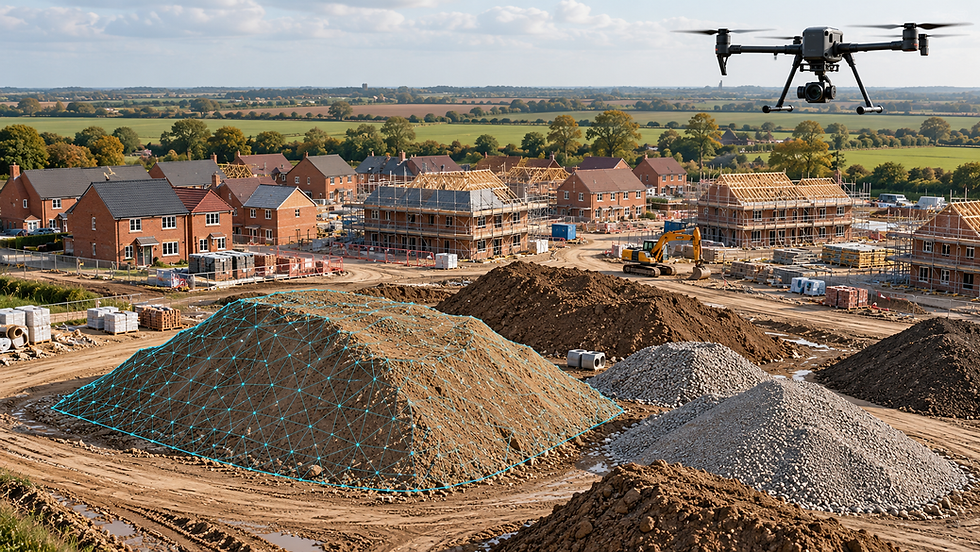
Achieving it requires ground control points: physical markers placed across the site and measured with survey-grade positioning equipment before the drone ever takes off. These markers anchor the photogrammetric model to reality. The quality of the ground control directly determines the precision of everything that follows. Without proper ground control, you are building calculations on foundations that do not exist.
Done properly, the results stand up to serious scrutiny. Peer-reviewed evaluation of drone photogrammetry for earthworks has found stockpile volumes agreeing with conventional ground survey to within 0.7 per cent on piles exceeding 530,000 cubic metres. That is engineering-grade performance. It only arrives when the methodology is survey-grade from the start.
So here is the distinction, stated plainly:
A drone shoot delivers: photographs and video. Useful for marketing, progress records, and stakeholder updates. Visually accurate, spatially meaningless.
A drone survey delivers: georeferenced, timestamped spatial data with documented accuracy, controlled against known ground coordinates, processed into outputs you can measure, calculate and build from.
Both involve a drone. The resemblance ends there.
The Cost of Getting This Wrong
When a shoot gets treated as a survey, the failure arrives quietly and late.
Someone pulls a volume figure from an uncontrolled model. A level gets read from imagery that was never corrected for terrain distortion. A boundary gets assumed from a photograph. On the day it happens, it looks like efficiency. The error only surfaces when concrete has been poured, material has been ordered, or a payment application lands on a commercial manager's desk.
The financial exposure is well documented. Rework costs the UK construction industry an estimated £21 billion every year — equivalent to 21 per cent of total sector output — and inaccurate or incomplete survey data is one of its most common root causes. A single incorrect level becomes a setting-out error, becomes rework, becomes programme slippage, becomes a claim. The folder of aerial photographs contributed nothing to preventing any of it, because it never contained measurable information.
The UK's construction adjudication system processed a record number of referrals in 2024, with inadequate contract administration and data disputes among the leading causes. A proper drone survey produces a georeferenced, timestamped digital record of the site exactly as it stood on a given day. When a volume figure is disputed six months later, that record settles the argument. Raw images without controlled processing offer no such protection. For contract administration, insurance claims and regulatory compliance, an objective spatial record is increasingly the expected standard — and increasingly, its absence is treated as a failure of professional duty.
What You Should Demand Before You Sign Off
You do not need to become a surveyor to protect yourself. You need to ask five questions, in writing, before you accept any drone deliverable as a survey.
1. Where is the ground control documentation?Ask how many ground control points were placed, how they were measured, and request the coordinate list. A provider who cannot answer this delivered a shoot.
2. What is the stated accuracy, and how was it verified?A genuine survey states its accuracy in measurable terms, typically centimetres in horizontal and vertical position, and verifies it against independent checkpoints that were excluded from the processing. Vague assurances of "high resolution" describe image sharpness, which has nothing to do with positional accuracy.
3. Which coordinate system are the outputs in?In the UK, expect outputs referenced to the Ordnance Survey National Grid and Ordnance Datum Newlyn, or to your project's specific site grid. Data that exists in no defined coordinate system cannot be integrated with your design models.
4. What processing was carried out, and by whom?Request the processing report. Photogrammetric software generates these automatically, and they document the quality of the model. A provider unwilling to share one is telling you something.
5. Is the dataset timestamped and archived as a site record?The audit trail is part of the product. Confirm the data will be retained in a form you can rely on if a measurement is challenged later.
Write these five requirements into your procurement documents. Providers who only fly cameras will withdraw at the first question. Providers who apply genuine surveying discipline will welcome the scrutiny. The questions act as a filter before the contract is signed rather than a post-mortem after the dispute.
Raising the Standard Serves Everyone
We run drone surveys for a living, so you are entitled to note our interest in this argument. We will accept that, because the argument stands on its own.
Drone photogrammetry and aerial LiDAR, applied to a surveying standard, are among the most capable measurement tools the construction industry has adopted in decades. Regular controlled flights replace multiple surveyor visits per week, and every dataset becomes a permanent, defensible record of the site. The technology earns its reputation when the discipline behind it is genuine.
That reputation suffers every time a folder of photographs gets invoiced as a survey and a project pays the price months later. The clients burned by that experience walk away distrusting the entire method, when the method was never applied in the first place.
So the standard needs stating clearly, and clients need to enforce it. A survey is defined by ground control, documented accuracy, rigorous processing and a defensible spatial record. Ask the five questions. Demand the documentation. Accept nothing labelled a survey until the provider proves it meets the definition.
Your project decisions deserve data you can measure, verify and defend. Insist on it.I


Comments