


Case Study: London Park LiDAR Topographical Survey

Using UAV LiDAR to Understand Surface Water Run-Off

Project Overview
UAV Surveys was commissioned to undertake a detailed topographical survey of a park in London, with the primary objective of providing accurate terrain information that could be used to understand how surface water moves across the site.
For this project, the quality of the underlying terrain model was particularly important. Small variations in level can significantly affect the direction of surface-water flow, particularly across apparently flat areas of parkland.
We therefore selected UAV LiDAR as the principal survey method, using the DJI Matrice 400 with the Zenmuse L3 LiDAR payload.
The survey was supported by a GNSS control network established specifically for the project, together with independently observed checkpoints used to verify the accuracy of the completed dataset.
Following acquisition, the LiDAR data was processed and analysed in Global Mapper before being taken into CAD to produce the client's final topographical survey.
From establishing the survey control through to supplying the completed CAD model, the entire project was completed in less than one week.
The Survey Requirement
The purpose of the survey was to provide the client with sufficiently detailed topographical information to investigate surface-water run-off across the park.
For drainage-related work, apparently insignificant changes in ground level can be important. A difference of only a few centimetres may influence whether water continues across a surface, changes direction or collects within a localised depression.
The survey therefore needed to provide much more than an aerial photograph of the site.
The resulting dataset needed to allow the client to examine existing ground levels, gradients, localised high and low points, depressions, potential flow paths and the relationship between the terrain and existing features throughout the park.
Rather than treating the UAV flight as the survey itself, UAV Surveys approached the project as a complete geospatial workflow, beginning with survey control and independent verification and finishing with a client-ready CAD deliverable.
Establishing the Survey Control Network
Before LiDAR acquisition commenced, UAV Surveys established a dedicated survey control network across the park.
This provided the spatial reference against which the aerial survey could be processed and assessed.
Each control target was observed using survey-grade GNSS equipment, with a three-minute observation undertaken at each position.
Rather than relying upon a single GNSS occupation, the control was observed during two separate observation windows.
Separating the observations in this way provides greater confidence in the resulting coordinates because the GNSS satellite constellation and geometry change over time. The second observation therefore provides an independent comparison rather than simply repeating measurements under effectively identical conditions.
The observations could then be compared to identify any unexpected discrepancy before the control was accepted for use within the survey.
This created a robust control framework for the UAV operation and, importantly, provided traceability between the measurements made on the ground and the subsequent aerial dataset.
Independent Checkpoints
In addition to the control used within the survey workflow, separate checkpoints were established across the site.
These points served a different purpose from the main survey control.
Control points can be used to establish or reference the survey dataset. Checkpoints, by contrast, are deliberately retained as independent observations and are not used to force the UAV-derived data to fit the survey control.
This distinction provides a much stronger method of verifying the finished survey.
Once the LiDAR dataset had been processed, elevations derived from the UAV survey could be compared against the independently surveyed checkpoint coordinates.
For each checkpoint, the surveyed GNSS position provided a known reference against which the corresponding LiDAR-derived surface could be tested.
The differences between the independently observed checkpoint values and the UAV-derived values could then be examined to determine how closely the processed survey represented the known ground positions.
This provides an important quality-control stage because a dataset can appear visually correct while still containing a systematic horizontal or vertical offset.
The checkpoints provide an independent means of identifying such discrepancies.
Distribution of Checkpoints
Checkpoint positioning was considered as part of the overall survey design rather than simply placing verification points close to the take-off location.
Where practical, checkpoints were distributed across the survey area so that different parts of the resulting model could be assessed.
This is particularly important for a larger topographical survey because checking several points concentrated within one small area provides relatively little evidence about the performance of the dataset elsewhere on the site.
A sensible distribution allows the surveyor to assess whether accuracy remains consistent across the project area and can help identify localised issues that may otherwise remain unnoticed.
The checkpoint assessment therefore formed part of the overall quality assurance process before the topographical information was released for CAD production.
Why Independent Verification Matters
Modern UAV systems can produce extremely accurate positioning information, particularly when operating with GNSS correction services and high-quality inertial navigation systems.
However, UAV Surveys does not consider the positioning information reported by the aircraft or processing software to be a substitute for independent survey verification.
For a professional topographical survey, there is an important difference between expected accuracy and demonstrated accuracy.
Manufacturer specifications, RTK status information and processing reports can indicate how a system should perform. Independently surveyed checkpoints provide evidence of how the complete survey actually performed on that particular site.
This distinction becomes particularly important when the dataset is being used for engineering purposes.
In this case, the client intended to use relatively small changes in elevation to understand surface-water movement. Confidence in the vertical component of the survey was therefore particularly important.
The checkpoint comparison provided an additional level of assurance that the terrain variations visible within the model represented genuine changes in the ground surface rather than an artefact of positioning or processing.
LiDAR Data Acquisition
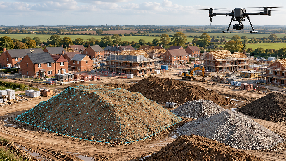
Once the control and verification network had been established, the park was surveyed using a DJI Matrice 400 equipped with the Zenmuse L3 LiDAR system.
LiDAR was selected because the project was fundamentally concerned with terrain rather than simply the appearance of the site.
Unlike conventional photogrammetry, which derives three-dimensional information by identifying common features between overlapping photographs, LiDAR directly measures ranges between the sensor and surfaces below the aircraft.
During the flight, the system generates a very large number of three-dimensional measurements, producing a dense point cloud representing the surveyed environment.
This was particularly useful within the park because vegetation and other features could obscure portions of the underlying terrain.
Multiple LiDAR returns can provide information from different levels within vegetation, allowing appropriate processing and classification techniques to be used to distinguish the underlying ground from vegetation and other above-ground features.
Why LiDAR Was Used for Surface-Water Mapping
Surface-water behaviour is fundamentally influenced by terrain.
Features that appear almost flat when viewed from ground level or conventional aerial photography can contain subtle variations that influence the direction in which water moves.
LiDAR allowed these variations to be represented across the site as a continuous three-dimensional dataset.
Rather than relying upon a comparatively small number of individually measured topographical points, the UAV survey provided dense coverage between those locations.
This gave the client a considerably more detailed representation of the terrain and made it possible to investigate subtle changes in gradient, localised depressions and potential routes through which surface water could move.
Processing in Global Mapper
Following completion of the flying, the LiDAR dataset was processed and analysed using Global Mapper.
The point cloud was reviewed and prepared for the production of the terrain information required by the client.
One of the key stages was identifying the points representing the underlying ground surface.
Trees, shrubs, street furniture and other above-ground objects all produce legitimate LiDAR returns, but these features are not necessarily appropriate when creating a terrain model intended to investigate drainage and surface-water movement.
Ground classification therefore allowed the underlying terrain to be separated from features sitting above it.
The resulting ground dataset could then be used to generate a detailed representation of the park's surface.
Verification of the Processed Surface
Before progressing to the final CAD production, the processed survey was checked against the independently surveyed checkpoints.
The LiDAR-derived position or surface elevation at each checkpoint location was compared with the corresponding GNSS observation.
This provided a direct measurement of the residual difference between the independently surveyed reference and the UAV-derived dataset.
Rather than quoting accuracy solely from the manufacturer's specification of the sensor, this approach allowed the performance of the actual survey to be assessed using measurements collected on the project itself.
Any unexpected residual would provide an indication that further investigation was required before the dataset was accepted.
This verification stage is particularly valuable for topographical surveys because errors can be introduced at several stages of a project, including coordinate-system configuration, GNSS positioning, transformation, sensor trajectory processing, point-cloud processing and subsequent data handling.
Independent checkpoints provide a final test of the combined workflow rather than testing just one component of it.
Only once the processed data had been reviewed against the verification points was the terrain information progressed into the final drawing stage.
From Point Cloud to CAD
A dense LiDAR point cloud provides an enormous amount of information, but millions of individual three-dimensional points are not necessarily the most convenient format for engineers and designers to use.
The processed survey information was therefore taken into CAD production.
Relevant topographical information was extracted from the verified dataset and drawn into a structured CAD survey, providing the client with a conventional engineering deliverable that could be incorporated into the wider project.
This transformed the high-density survey data into an intelligible model of the park while retaining the underlying detail necessary to represent changes in terrain.
The CAD output provided a clear representation of site levels and topography, allowing the client to interrogate the information and use it as the basis for its assessment of surface-water behaviour.
Understanding Water Movement Across the Park
Once the verified terrain model had been produced, the relationship between different areas of the park became considerably easier to understand.
Changes in elevation could be followed continuously across the site rather than being considered solely as isolated survey points.
This allowed the client to investigate where water was likely to travel following rainfall, where different flow paths could potentially converge and where localised depressions could encourage water to collect.
The survey itself did not replace a hydrological or hydraulic assessment. Instead, it provided the detailed and independently checked topographical foundation upon which those engineering assessments could be based.
That distinction is important.
Any assessment of surface-water behaviour is dependent upon the quality of the terrain information supporting it. High-density LiDAR provided the detail, while the ground-control and independent checkpoint observations provided the means of checking that the resulting model accurately represented the site.
A Complete Survey in Less Than One Week
One of the major advantages of the UAV approach was the speed with which the complete project could be delivered.
Within less than one week, UAV Surveys was able to establish the control and verification network, complete two GNSS observation windows, undertake the UAV LiDAR survey, process and classify the point cloud, verify the resulting dataset against independent checkpoints, generate the required terrain information and produce the final CAD survey.
The efficiency therefore extended far beyond the time taken to fly the site.
By combining survey control, independent verification, high-density LiDAR acquisition, geospatial processing and CAD production within a single workflow, we were able to move quickly from field survey to information the client could use.
The Result
The completed project provided the client with a detailed three-dimensional representation of the London park and a CAD topographical model suitable for subsequent drainage and engineering assessment.
The DJI Matrice 400 and Zenmuse L3 provided the density of information required to represent subtle changes across the terrain, while Global Mapper provided the environment for processing, classifying and analysing the resulting point cloud.
Just as importantly, the survey was supported by a separately observed GNSS control network and independent checkpoints.
This allowed the quality of the final dataset to be demonstrated against measurements collected independently on the ground rather than relying solely upon the reported accuracy of the UAV and LiDAR system.
From the first control observation to delivery of the completed CAD survey, the entire process took less than one week.
UAV Surveys
At UAV Surveys, we don't simply fly a drone and hand over a point cloud.
Our approach combines survey control, independent verification, specialist UAV platforms, LiDAR and photogrammetric sensors, geospatial processing and CAD production to provide complete survey deliverables.
For projects involving drainage, earthworks, complex terrain, vegetation or large areas, UAV LiDAR can provide an exceptionally detailed representation of existing ground conditions while significantly reducing the time required to collect information in the field.
Most importantly, the combination of high-density data and independently surveyed checkpoints means that the finished product can be assessed against real measurements collected on the site.
For our clients, that means receiving more than a visually impressive point cloud. It means receiving a surveyed, checked and usable engineering dataset.


Comments