


Drone Stockpile Surveying on a Norfolk Housing Development

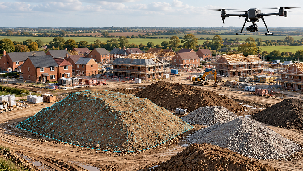
UAV Surveys Ltd used a DJI Matrice 400 equipped with a Zenmuse P1 to carry out a stockpile survey on a new build housing estate in Norfolk.
Material management is a daily consideration on a housing development. As excavation and construction progress, stockpiles grow, move and reduce. Understanding the quantities held on site helps contractors plan earthworks, assess material available for reuse and make informed decisions about removal or further deliveries.
For this project, we used aerial photogrammetry to capture the stockpiles, providing the survey imagery needed to assess their shape and calculate material volumes.
The challenge
Stockpiles rarely form neat, regular shapes. Their surfaces include ridges, steep faces and depressions, while their bases may sit on sloping or uneven ground. These variations make visual estimates unreliable and can be difficult to represent using a limited number of surveyed points.
An active housing development also presents practical constraints. Survey work needs to account for construction traffic, moving plant, site personnel and changing access arrangements. Aerial capture allows the visible stockpile surfaces to be recorded without requiring a surveyor to walk across each pile.
Capturing the stockpiles
The DJI Matrice 400 and Zenmuse P1 formed the aerial survey platform for the Norfolk project. The P1 captured photographs for photogrammetric processing, which uses overlapping images to reconstruct surfaces in three dimensions.
For stockpile measurement, coverage needs to extend beyond the crest of each pile. The sides, toe and surrounding ground all contribute to understanding its geometry and defining the area included in the calculation.
This approach provides a detailed representation of the visible surface, including variations that can be missed when a pile is treated as a simple geometric shape.
From aerial imagery to material quantities
Photogrammetric processing turns overlapping survey photographs into a three-dimensional model. This provides the surface from which individual stockpiles can be outlined and their volumes assessed.
The base surface is a critical part of that assessment. A drone records the exposed material; it cannot see the ground buried beneath it. Where a survey taken before material was deposited is available, that information can provide the reference surface. Otherwise, the base must be estimated using appropriate surrounding ground information, with the assumption made clear.
Comparing the stockpile surface with the selected base produces a volume in cubic metres. Any conversion to tonnage requires an appropriate material density, taking account of factors such as moisture and compaction.
Practical value for the site team
Stockpile measurements can support several aspects of housing development work, from planning material movements to checking quantities against ea
rthworks records.
Knowing what is held on site helps the project team assess whether suitable material is available for forthcoming work and whether surplus material may require removal. The accompanying imagery also provides context, showing where piles sit in relation to access routes, working areas and the wider development.
Repeat surveys can build on this record to track changes over time. Consistent boundaries and base surfaces are essential when comparing quantities between survey dates.
Stockpile surveying for residential developments
The Norfolk project demonstrates an application of the DJI Matrice 400 and Zenmuse P1 within construction surveying: capturing stockpile geometry to support volumetric assessment.
For developers and groundworks contractors, the value lies in having measured information to support decisions about the material on their site.
UAV Surveys Ltd provides stockpile surveys, aerial mapping and earthworks surveys across Norfolk, East Anglia and throughout the UK.


Comments